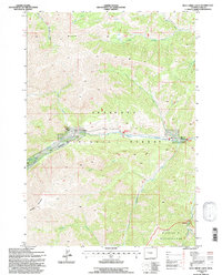
1991 Map of Dick Creek Lakes
USGS Topo · Published 1997About this map
Shoshone National Forest dominates this mountain landscape, which was updated by the Forest Service in the early 1990s. The terrain is defined by the high elevations of Brown Mountain and Dundee Mountain, between which the Wood River and its various forks carve deep drainage patterns. A notable human imprint in this otherwise roadless expanse is the Double D Ranch, situated along the river west of The Meadows. The map illustrates the complex hydrology of the high country, including the isolated Dick Creek Lakes and numerous seasonal tributaries like Meadow Cr and Jojo Creek. This 1991 revision also shows the northern reaches of the Washakie Wilderness, highlighting the intersection of managed forest lands and protected primitive areas where the South Fork Wood River meets the Forest Service boundary.
Find a feature on this map
23 named features on this map. Tap any name to fly to it.
Don’t see what you’re looking for? This feature index may not catch every label — zoom into the map to look around manually.
Map Details
Editions of this 1991 Dick Creek Lakes Map
This is the sole edition of this map. No revisions or reprints were ever made.
Other maps of this area

1904 · Kirwin
USGS Topo · 1:125,000

1906 · Kirwin
USGS Topo · 1:125,000

1955 · Cody
USGS Topo · 1:250,000

1955 · Thermopolis
USGS Topo · 1:250,000

1957 · Irish Rock
USGS Topo · 1:62,500

1957 · Sunshine Reservoir
USGS Topo · 1:62,500

1958 · Cody
USGS Topo · 1:250,000

1958 · Thermopolis
USGS Topo · 1:250,000

1962 · Thermopolis
USGS Topo · 1:250,000

1962 · Cody
USGS Topo · 1:250,000