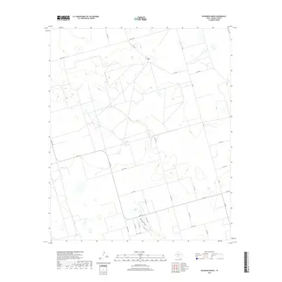
2019 Map of Dickenson Ranch
USGS Topo · Published 2019About this map
Mustang Spring serves as a focal point in this portion of Martin County, sitting just north of the significant geographic feature Mustang Draw. The landscape is defined by the expansive Dickenson Ranch and a network of agricultural and ranching corridors. The 2019 survey illustrates the modern layout of rural infrastructure, where major routes like Fm 829 and E Fm 1212 intersect with a grid of county roads such as Co RD 2600 and Co RD 2801. The map reveals a land usage pattern dominated by large-scale ranching and mineral extraction access, typical of the Permian Basin region. Many smaller thoroughfares, including Co RD c2330 and Farm Rd 1208, provide detailed connectivity to the various homesteads and worksites scattered across the plains.
Find a feature on this map
26 named features on this map. Tap any name to fly to it.
Don’t see what you’re looking for? This feature index may not catch every label — zoom into the map to look around manually.
Map Details
Editions of this 2019 Dickenson Ranch Map
This is the sole edition of this map. No revisions or reprints were ever made.
Other maps of this area

1954 · Hobbs
USGS Topo · 1:250,000

1954 · Big Spring
USGS Topo · 1:250,000

1958 · Big Spring
USGS Topo · 1:250,000

1958 · Hobbs
USGS Topo · 1:250,000

1965 · Northeast Midland
USGS Topo · 1:24,000

1966 · Lenorah West
USGS Topo · 1:24,000

1966 · Flynt Ranch
USGS Topo · 1:24,000
1966 · Germania
USGS Topo · 1:24,000

1966 · North Curtis Ranch
USGS Topo · 1:24,000

1966 · Stanton
USGS Topo · 1:24,000