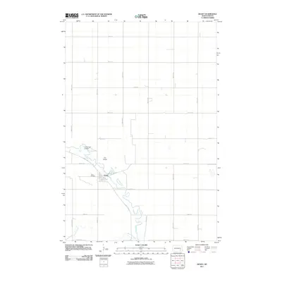
2011 Map of Dickey
USGS Topo · Published 2011About this map
The small town of Dickey serves as the focal point for this landscape along the winding path of the James River in LaMoure County. The town layout is clearly defined by residential streets such as Main St, 3rd St, and Elder Ave, anchored by the Dickey Cemetery situated on the western edge of the settlement. The surrounding terrain is characterized by the agricultural grid of the Great Plains, interrupted by natural drainage features including Sevenmile Coulee, Dry Coulee, and the southward-flowing Bone Hill Creek. This 2011 survey documents the rural infrastructure of the region, showing the primary transport links of County Rd 63 and County Rd 35 that connect the isolated farmsteads and field systems to the village center and the river valley.
Find a feature on this map
32 named features on this map. Tap any name to fly to it.
Don’t see what you’re looking for? This feature index may not catch every label — zoom into the map to look around manually.
Map Details
Editions of this 2011 Dickey Map
This is the sole edition of this map. No revisions or reprints were ever made.
Other maps of this area

1894 · La Moure
USGS Topo · 1:62,500

1895 · Lamoure
USGS Topo · 1:125,000

1896 · Jamestown
USGS Topo · 1:125,000

1896 · Edgeley
USGS Topo · 1:125,000

1897 · Eckelson
USGS Topo · 1:125,000

1918 · La Moure
USGS Topo · 1:125,000

1925 · Edgeley
USGS Topo · 1:125,000

1952 · Dickey
USGS Topo · 1:24,000

1952 · Grand Rapids
USGS Topo · 1:24,000

1953 · Jamestown
USGS Topo · 1:250,000