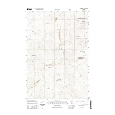
2014 Map of Dickie Peak
USGS Topo · Published 2014About this map
Dickie Peak and Johnson Peak anchor this high-altitude landscape along the divide between Deer Lodge and Silver Bow counties. The area is defined by its deep drainages, including French Gulch and German Gulch, which historically served as corridors for early settlement and mining activity. The small community of French Town sits nestled among these drainages, reflecting the 19th-century influence of French-Canadian prospectors in the region.
Find a feature on this map
45 named features on this map. Tap any name to fly to it.
Don’t see what you’re looking for? This feature index may not catch every label — zoom into the map to look around manually.
Map Details
Editions of this 2014 Dickie Peak Map
This is the sole edition of this map. No revisions or reprints were ever made.
Other maps of this area

1889 · Helena
USGS Topo · 1:250,000

1893 · Helena
USGS Topo · 1:250,000

1893 · Dillon
USGS Topo · 1:250,000

1899 · Helena
USGS Topo · 1:250,000

1903 · Helena
USGS Topo · 1:250,000

1908 · Philipsburg
USGS Topo · 1:125,000

1947 · Butte
USGS Topo · 1:250,000

1955 · Dillon
USGS Topo · 1:250,000

1957 · Dillon
USGS Topo · 1:250,000

1958 · Butte
USGS Topo · 1:250,000