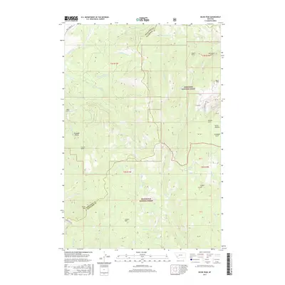
2017 Map of Dickie Peak
USGS Topo · Published 2017About this map
French Town sits at the edge of a high-altitude drainage network where the Beaverhead National Forest meets the Deerlodge National Forest. This 2017 survey details the complex topography of the Continental Divide region along the boundary of Deer Lodge and Silver Bow Counties. The landscape is defined by deep incisions like French Gulch and Coyote Gulch, which channel snowmelt from prominent summits such as Dickie Peak and Johnson Peak. The map reveals a land utilized for both timber management and high-country recreation, evidenced by the presence of Fish Lake and Mud Lake. Significant drainages including American Cr and German Gulch are traced through their upper reaches, while high meadows like Selway Meadows and New Meadows provide breaks in the forested terrain, illustrating the remote and specialized nature of this Montana mountain environment.
Find a feature on this map
85 named features on this map. Tap any name to fly to it.
Don’t see what you’re looking for? This feature index may not catch every label — zoom into the map to look around manually.
Map Details
Editions of this 2017 Dickie Peak Map
This is the sole edition of this map. No revisions or reprints were ever made.
Other maps of this area

1889 · Helena
USGS Topo · 1:250,000

1893 · Helena
USGS Topo · 1:250,000

1893 · Dillon
USGS Topo · 1:250,000

1899 · Helena
USGS Topo · 1:250,000

1903 · Helena
USGS Topo · 1:250,000

1908 · Philipsburg
USGS Topo · 1:125,000

1947 · Butte
USGS Topo · 1:250,000

1955 · Dillon
USGS Topo · 1:250,000

1957 · Dillon
USGS Topo · 1:250,000

1958 · Butte
USGS Topo · 1:250,000