
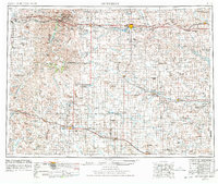
1953 Map of Dickinson
USGS Topo · Published 1968About this map
The badlands of Theodore Roosevelt National Memorial Park South Unit dominate the northwestern corner of this mid-century survey, where the Little Missouri River carves through Painted Canyon and Big Plateau. Further east, the prairie landscape is defined by the headwaters of the Heart River and the Cannonball River, which supported a network of small agricultural settlements and rural schools such as Hegseth School and Fisher School. The Northern Pacific railroad corridor serves as the primary spine of development, connecting towns like Dickinson, Belfield, and Richardton.
Find a feature on this map
271 named features on this map. Tap any name to fly to it.
Don’t see what you’re looking for? This feature index may not catch every label — zoom into the map to look around manually.
Map Details
Editions of this 1953 Dickinson Map
2 editions found
Other maps of this area

1909 · Glendive
USGS Topo · 1:250,000

1935 · Reva
USGS Topo · 1:125,000

1935 · Buffalo
USGS Topo · 1:125,000

1938 · Heart Butte
USGS Topo · 1:48,000

1944 · Heart Butte
USGS Topo · 1:62,500

1953 · McIntosh
USGS Topo · 1:250,000

1953 · Miles City
USGS Topo · 1:250,000

1953 · Watford City
USGS Topo · 1:250,000

1954 · Lemmon
USGS Topo · 1:250,000

1954 · Ekalaka
USGS Topo · 1:250,000