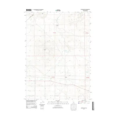
2013 Map of Dietrich Butte
USGS Topo · Published 2013About this map
Dietrich Butte rises as a prominent landmark in this Lincoln County landscape, defining the topography north of the small settlement of Besslen. The area is characterized by an extensive network of irrigation infrastructure essential to the high desert, including the Dietrich Main Canal and several specialized laterals such as Lateral 614 and Lateral 702. These water systems feed several named catchments, from the Crater Reservoir on the slopes of the butte to the remote West Monument Reservoir in the east.
Find a feature on this map
26 named features on this map. Tap any name to fly to it.
Don’t see what you’re looking for? This feature index may not catch every label — zoom into the map to look around manually.
Map Details
Editions of this 2013 Dietrich Butte Map
This is the sole edition of this map. No revisions or reprints were ever made.
Other maps of this area

1955 · Twin Falls
USGS Topo · 1:250,000

1955 · Hailey
USGS Topo · 1:250,000

1958 · Twin Falls
USGS Topo · 1:250,000

1959 · Hailey
USGS Topo · 1:250,000

1962 · Hailey
USGS Topo · 1:250,000

1971 · Shoshone SE
USGS Topo · 1:24,000

1971 · Star Lake
USGS Topo · 1:24,000

1971 · Owinza
USGS Topo · 1:24,000

1971 · Dietrich
USGS Topo · 1:24,000

1971 · Dietrich Butte
USGS Topo · 1:24,000