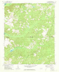
1971 Map of Diggs
USGS Topo · Published 1973About this map
Diggs and Osborne sit along the path of the Seaboard Coast Line railroad as it cuts through the borderlands between North Carolina and South Carolina. This rural landscape in Richmond and Marlboro counties is defined by its watercourses and small community centers. To the west, the Pee Dee R marks the county line, while inland, a network of drainages including Marks Creek and Whites Creek flow through the timbered terrain. Numerous country churches and cemeteries, such as Pleasant Grove Ch, St Stephens Cem, and Whites Creek Ch, serve as the primary anchors for the scattered local population.
Find a feature on this map
35 named features on this map. Tap any name to fly to it.
Don’t see what you’re looking for? This feature index may not catch every label — zoom into the map to look around manually.
Map Details
Editions of this 1971 Diggs Map
2 editions found
Other maps of this area

1942 · Rockingham
USGS Topo · 1:125,000

1949 · Ghio
USGS Topo · 1:24,000

1949 · Hamlet
USGS Topo · 1:24,000

1949 · Hamlet
USGS Topo · 1:62,500

1953 · Florence
USGS Topo · 1:250,000

1954 · Florence
USGS Topo · 1:250,000
1956 · Rockingham
USGS Topo · 1:24,000
1956 · Lilesville
USGS Topo · 1:24,000
1957 · Hamlet
USGS Topo · 1:24,000
1971 · Morven East
USGS Topo · 1:24,000