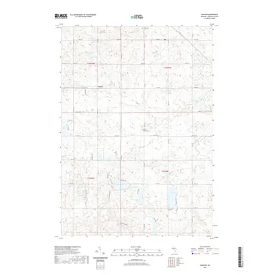
2019 Map of Dighton
USGS Topo · Published 2019About this map
The small settlement of Dighton sits at the intersection of a grid-like road network in this section of Osceola County, Michigan. This landscape is defined by its glacial hydrology, with dozens of named kettle lakes and wetlands scattered across the terrain. To the south and east, the Middle Br River winds through the lowlands, joined by several tributaries including Beebe Cr and Franz Cr. Cultural history is anchored by local landmarks such as Highland Cem in the north and Maple Valley Cem near the center. The abundance of water bodies, from the larger Hicks Lake and Rose Lake to smaller basins like Halfmoon Lake and Little Long Lake, suggests a region deeply tied to seasonal recreation and local drainage patterns. Significant forest and wetland trails like Pine Ridge Trl and Sunset Trl provide access through the dense network of swamps and ridges surrounding the Rendezvous Lake area.
Find a feature on this map
42 named features on this map. Tap any name to fly to it.
Don’t see what you’re looking for? This feature index may not catch every label — zoom into the map to look around manually.
Map Details
Editions of this 2019 Dighton Map
This is the sole edition of this map. No revisions or reprints were ever made.
Other maps of this area

1954 · Traverse City
USGS Topo · 1:250,000

1954 · Midland
USGS Topo · 1:250,000

1957 · Cadillac South
USGS Topo · 1:62,500

1957 · Marion
USGS Topo · 1:62,500

1958 · Traverse City
USGS Topo · 1:250,000

1958 · Midland
USGS Topo · 1:250,000

1959 · Midland
USGS Topo · 1:250,000

1959 · Lake
USGS Topo · 1:62,500

1959 · Evart
USGS Topo · 1:62,500

1966 · Midland
USGS Topo · 1:250,000