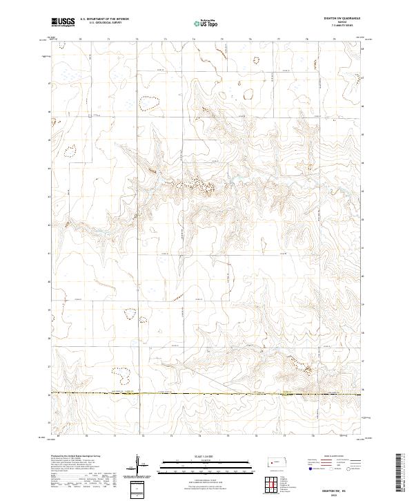
2022 Map of Dighton SW
USGS Topo · Published 2022About this map
Hackberry Cr carves a distinctive drainage pattern across the high plains of western Kansas, defining the topographic relief of this rural landscape. The map captures the boundary between Lane Co and Finney Co, a line traced by Lane-Finney Rd at the southern edge of the quadrangle. The region is organized by a precise grid of sectional roads, reflecting the enduring legacy of the Public Land Survey System in the American West. Named corridors like Ogallalah Rd, Mustang Rd, and Longhorn Rd provide access to the vast agricultural tracts between township lines. This 2022 survey illustrates the intersection of modern county infrastructure and the natural hydrologic features of the High Plains, where drainage branches like those of Hackberry Creek disrupt the otherwise uniform township and range grid.
Find a feature on this map
22 named features on this map. Tap any name to fly to it.
Don’t see what you’re looking for? This feature index may not catch every label — zoom into the map to look around manually.
Map Details
Editions of this 2022 Dighton SW Map
This is the sole edition of this map. No revisions or reprints were ever made.
Other maps of this area

1955 · Scott City
USGS Topo · 1:250,000

1958 · Scott City
USGS Topo · 1:250,000

1974 · Ravanna
USGS Topo · 1:24,000

1974 · Dighton SW
USGS Topo · 1:24,000

1974 · Amy SE
USGS Topo · 1:24,000

1974 · Dighton
USGS Topo · 1:24,000

1974 · Scott City 4 NE
USGS Topo · 1:24,000

1974 · Alamota
USGS Topo · 1:24,000

1974 · Hay Canyon
USGS Topo · 1:24,000

1974 · Dighton SE
USGS Topo · 1:24,000