
1970 Map of Diller NE
USGS Topo · Published 1971About this map
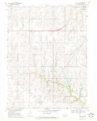
The Chicago Rock Island and Pacific railroad forms a distinct horizontal axis across this landscape, dividing the northern townships of Lincoln and Riverside from Elm and Sicily to the south. The small settlement of Ellis serves as a primary point of interest along these tracks, while the larger city of Beatrice appears at the northeastern corner. The terrain is defined by a dense network of drainage, where Bottle Creek, Bills Creek, and Sicily Creek carve through the agricultural uplands. Genealogy researchers will find value in the precise locations of the Ellis Cem and Pleasant Hill Cem, alongside recreation landmarks like the Hidden Acres Country Club. The presence of several industrial pipelines and a local Sandpit reflects the infrastructure of the Missouri River Basin during this era of rural development.
Find a feature on this map
16 named features on this map. Tap any name to fly to it.
Don’t see what you’re looking for? This feature index may not catch every label — zoom into the map to look around manually.
Map Details
Editions of this 1970 Diller NE Map
2 editions found
Other maps of this area

1955 · Lincoln
USGS Topo · 1:250,000

1957 · Lincoln
USGS Topo · 1:250,000

1957 · Plymouth
USGS Topo · 1:24,000

1957 · Beatrice West
USGS Topo · 1:24,000

1957 · Beatrice East
USGS Topo · 1:24,000

1958 · Lincoln
USGS Topo · 1:250,000

1964 · Blue Springs
USGS Topo · 1:24,000
1970 · Wymore
USGS Topo · 1:24,000
1970 · Harbine
USGS Topo · 1:24,000

1970 · Diller
USGS Topo · 1:24,000