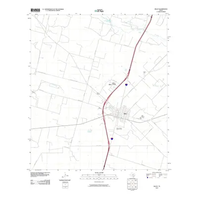
2010 Map of Dilley
USGS Topo · Published 2010About this map
The town of Dilley serves as the central hub of this South Texas landscape, where the intersection of major thoroughfares and rural farm-to-market roads defines the local geography. The map reveals a community deeply rooted in its local institutions, from the Winter Garden Rodeo Ground on the southern edge of town to the Dilley Airpark situated to the northwest. These landmarks, alongside the Dilley Cemetery, illustrate a settled landscape structured by both modern transit and traditional community spaces.
Find a feature on this map
31 named features on this map. Tap any name to fly to it.
Don’t see what you’re looking for? This feature index may not catch every label — zoom into the map to look around manually.
Map Details
Editions of this 2010 Dilley Map
This is the sole edition of this map. No revisions or reprints were ever made.
Other maps of this area

1925 · Pearsall 1-c
USGS Topo · 1:48,000

1927 · Pearsall
USGS Topo · 1:62,500

1942 · Divot
USGS Topo · 1:62,500

1942 · Dilley
USGS Topo · 1:62,500

1953 · Crystal City
USGS Topo · 1:250,000

1955 · Crystal City
USGS Topo · 1:250,000

1956 · Woodward
USGS Topo · 1:62,500

1956 · Divot
USGS Topo · 1:62,500

1961 · Crystal City
USGS Topo · 1:250,000

1964 · Pearsall South
USGS Topo · 1:24,000