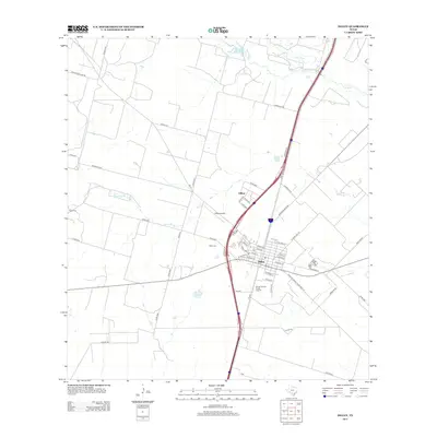
2013 Map of Dilley
USGS Topo · Published 2013About this map
Dilley serves as the central hub of this South Texas landscape, where a grid of town streets like Kinsel St and E Frio St meets the transit corridors of the modern era. The town's community heritage is visible in the presence of the Winter Garden Rodeo Ground, while its aviation footprint is marked by the Dilley Airpark to the north. Outside the town center, the terrain is defined by a network of drainage ways and creeks, including the Frio River, the Leona River, and multiple branches of Martin Br. For genealogists and local historians, the placement of rural burial grounds like Hugo Cem and Diller Cem provides key landmarks for tracing early settlement patterns. To the north, the small community of Hilltop sits along the primary highway artery, surrounded by ranch roads such as Charolais Rd and Panther Hollow Rd.
Find a feature on this map
54 named features on this map. Tap any name to fly to it.
Don’t see what you’re looking for? This feature index may not catch every label — zoom into the map to look around manually.
Map Details
Editions of this 2013 Dilley Map
This is the sole edition of this map. No revisions or reprints were ever made.
Other maps of this area

1925 · Pearsall 1-c
USGS Topo · 1:48,000

1927 · Pearsall
USGS Topo · 1:62,500

1942 · Divot
USGS Topo · 1:62,500

1942 · Dilley
USGS Topo · 1:62,500

1953 · Crystal City
USGS Topo · 1:250,000

1955 · Crystal City
USGS Topo · 1:250,000

1956 · Woodward
USGS Topo · 1:62,500

1956 · Divot
USGS Topo · 1:62,500

1961 · Crystal City
USGS Topo · 1:250,000

1964 · Pearsall South
USGS Topo · 1:24,000