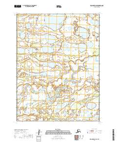
2019 Map of Dillingham A-2 SW
USGS Topo · Published 2019About this map
Alagnak River meanders across this wild terrain in southwestern Alaska, defining the hydrological character of the landscape. This 2019 survey captures the river's complex braided channels and the surrounding network of lakes and wetlands that dominate the t13s r44w and t13s r45w townships. The map reveals an environment where water and land are in constant flux, providing a precise record of the shoreline and marsh boundaries as they appeared in the early 21st century. While the area lacks developed roads or named settlements, the intricate detail of the Alagnak River drainage basin offers essential data for those studying the remote geography of the Lake and Peninsula Borough.
Find a feature on this map
5 named features on this map. Tap any name to fly to it.
Don’t see what you’re looking for? This feature index may not catch every label — zoom into the map to look around manually.
Map Details
Editions of this 2019 Dillingham A-2 SW Map
This is the sole edition of this map. No revisions or reprints were ever made.
Other maps of this area

1951 · Dillingham
USGS Topo · 1:250,000

1952 · Naknek
USGS Topo · 1:250,000

1952 · Dillingham A-2
USGS Topo · 1:63,360

1952 · Naknek D-2
USGS Topo · 1:63,360

1952 · Dillingham A-3
USGS Topo · 1:63,360

1952 · Naknek D-3
USGS Topo · 1:63,360

1954 · Dillingham
USGS Topo · 1:250,000

1964 · Naknek
USGS Topo · 1:250,000
2019 · Dillingham A-3 SE
USGS Topo · 1:25,000
2019 · Dillingham A-2 SE
USGS Topo · 1:25,000