
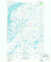
1952 Map of Naknek D-3
USGS Topo · Published 1963About this map
The Kvichak River dominates this portion of the Bristol Bay region, characterized by a complex network of hundreds of small, unnamed lakes and ponds typical of the Alaska tundra. Near the river's eastern bank, the settlement of Kvichak sits at a narrow point across from expansive sand bars, including Sea Gull Flat. This landscape is shaped by the shifting waters of the Coffee Creek Channel and Coffee Creek, which weave through the mud and sand of the coastal plain.
Find a feature on this map
9 named features on this map. Tap any name to fly to it.
Don’t see what you’re looking for? This feature index may not catch every label — zoom into the map to look around manually.
Map Details
Editions of this 1952 Naknek D-3 Map
2 editions found
Other maps of this area

1951 · Dillingham
USGS Topo · 1:250,000

1952 · Naknek
USGS Topo · 1:250,000

1952 · Dillingham A-2
USGS Topo · 1:63,360

1952 · Naknek D-2
USGS Topo · 1:63,360

1952 · Naknek C-2
USGS Topo · 1:63,360

1952 · Naknek C-3
USGS Topo · 1:63,360

1952 · Dillingham A-3
USGS Topo · 1:63,360

1952 · Naknek D-4
USGS Topo · 1:63,360

1952 · Naknek C-4
USGS Topo · 1:63,360

1954 · Dillingham
USGS Topo · 1:250,000