
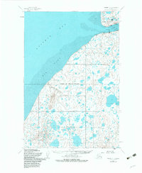
1952 Map of Naknek C-4
USGS Topo · Published 1963About this map
Naknek and South Naknek anchor the mouth of the Naknek River where it meets the waters of Kvichak Bay in this 1952 study. The landscape is defined by the massive coastal Big Flat and the prominent Cape Suwarof, revealing an economy built around the sea and local transport. A Cannery and a Landing Strip near the river mouth highlight the seasonal industry and aviation reliance of the Bristol Bay region.
Find a feature on this map
17 named features on this map. Tap any name to fly to it.
Don’t see what you’re looking for? This feature index may not catch every label — zoom into the map to look around manually.
Map Details
Editions of this 1952 Naknek C-4 Map
2 editions found
Other maps of this area

1952 · Naknek
USGS Topo · 1:250,000

1952 · Naknek B-3
USGS Topo · 1:63,360

1952 · Naknek C-5
USGS Topo · 1:63,360

1952 · Naknek B-4
USGS Topo · 1:63,360

1952 · Naknek B-5
USGS Topo · 1:63,360

1952 · Naknek C-3
USGS Topo · 1:63,360

1952 · Naknek D-5
USGS Topo · 1:63,360

1952 · Naknek D-3
USGS Topo · 1:63,360

1952 · Naknek D-4
USGS Topo · 1:63,360

1964 · Naknek
USGS Topo · 1:250,000