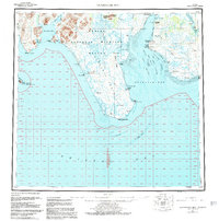
1951 Map of Nushagak Bay
USGS Topo · Published 1983About this map
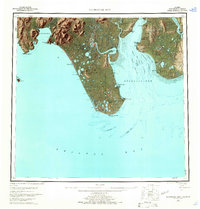
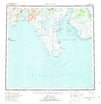
Manokotak and the fishing settlements of the Bristol Bay region anchor this mid-century topographic study. The landscape is defined by the complex aquatic network of Nushagak Bay, where the Nushagak River and Snake River meet the sea amidst extensive Tidal Flats. This era of the region’s development is characterized by the vital maritime industry, marked by the presence of numerous Canneries and a Landing Strip serving remote outposts. Further west, the Togiaak National Wildlife Refuge and the Walrus Islands State Game Sanctuary protect the coastal wilderness, including Round I. Geologic and navigational details like Ekuk Bluff and the deep Ship Channel illustrate the challenges and routes of the local salmon fleet and coastal traders during a period when these waters were the primary lifelines for the communities of Clarks Point and Ekuk.
Find a feature on this map
50 named features on this map. Tap any name to fly to it.
Don’t see what you’re looking for? This feature index may not catch every label — zoom into the map to look around manually.
Map Details
Editions of this 1951 Nushagak Bay Map
7 editions found

Other maps of this area

1943 · Ugashik
USGS Topo · 1:250,000

1945 · Nushagak Bay
USGS Topo · 1:250,000

1948 · Ugashik
USGS Topo · 1:250,000

1948 · Nushagak Bay D-4
USGS Topo · 1:63,360

1948 · Nushagak Bay D-3
USGS Topo · 1:63,360

1948 · Nushagak Bay C-4 And C-5
USGS Topo · 1:63,360

1948 · Hagemeister Island C-1
USGS Topo · 1:63,360

1949 · Ugashik
USGS Topo · 1:250,000

1949 · Nushagak Bay
USGS Topo · 1:250,000

1950 · Nushagak Bay B-4
USGS Topo · 1:63,360