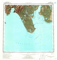
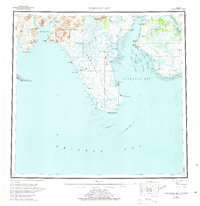
1951 Map of Nushagak Bay
USGS Topo · Published 1965About this map
Bristol Bay's commercial fishing and canning industry is the central focus of this mid-century survey, specifically highlighting the waters of Nushagak Bay. The map documents a cluster of industrial activity near Clarks Point, where Canneries and Ekuk sit at the mouth of the Nushagak River. To the west, the remote landscape of the Third Judicial Division is marked by the Igushik River and a Cannery at the base of Igushik Ridge. Further west, indigenous and seasonal settlements like Kulukak and Tuklung appear along the rugged coastline of Kulukak Bay. Navigational hazards such as the Schooner Channel, Ship Channel, and the shifting Tidal Flat areas around Protection Pt illustrate the maritime complexity of this salmon-rich region before significant modern development altered these coastal interfaces.
Find a feature on this map
70 named features on this map. Tap any name to fly to it.
Don’t see what you’re looking for? This feature index may not catch every label — zoom into the map to look around manually.
Map Details
Editions of this 1951 Nushagak Bay Map
7 editions found

Other maps of this area

1943 · Ugashik
USGS Topo · 1:250,000

1945 · Nushagak Bay
USGS Topo · 1:250,000

1948 · Ugashik
USGS Topo · 1:250,000

1948 · Nushagak Bay D-4
USGS Topo · 1:63,360

1948 · Nushagak Bay D-3
USGS Topo · 1:63,360

1948 · Nushagak Bay C-4 And C-5
USGS Topo · 1:63,360

1948 · Hagemeister Island C-1
USGS Topo · 1:63,360

1949 · Ugashik
USGS Topo · 1:250,000

1949 · Nushagak Bay
USGS Topo · 1:250,000

1950 · Nushagak Bay B-4
USGS Topo · 1:63,360