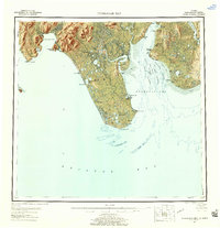
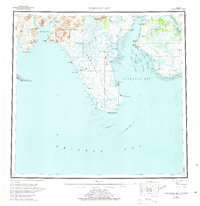
1951 Map of Nushagak Bay
USGS Topo · Published 1958About this map
Nushagak Bay is the focal point of this mid-century survey, revealing a landscape defined by its intricate shoreline and maritime economy. The complex navigation of the region is mapped through a series of tidal channels, including the Middle Channel, West Channel, and Schooner Channel, which wind through extensive Tidal Flats and Long Sands. At this time, the shoreline supported several established communities and industrial sites, notably around Clarks Point and Ekuk, where Canneries and a Cannery are specifically marked, highlighting the importance of the salmon fishery to the Third Judicial Division. Inland, the topography rises toward Acorn Peak and the Nushagak Hills, while the low-lying peninsula terminating at Cape Constantine is punctuated by significant water bodies like Kikertalik Lake. The map preserves the location of the Igushik (Site) and older outposts like Nushagak and Kanakanak, documenting the settlement patterns of Bristol Bay before later decades of change.
Find a feature on this map
50 named features on this map. Tap any name to fly to it.
Don’t see what you’re looking for? This feature index may not catch every label — zoom into the map to look around manually.
Map Details
Editions of this 1951 Nushagak Bay Map
7 editions found

Other maps of this area

1943 · Ugashik
USGS Topo · 1:250,000

1945 · Nushagak Bay
USGS Topo · 1:250,000

1948 · Ugashik
USGS Topo · 1:250,000

1948 · Nushagak Bay D-4
USGS Topo · 1:63,360

1948 · Nushagak Bay D-3
USGS Topo · 1:63,360

1948 · Nushagak Bay C-4 And C-5
USGS Topo · 1:63,360

1948 · Hagemeister Island C-1
USGS Topo · 1:63,360

1949 · Ugashik
USGS Topo · 1:250,000

1949 · Nushagak Bay
USGS Topo · 1:250,000

1950 · Nushagak Bay B-4
USGS Topo · 1:63,360