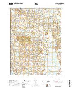
2019 Map of Dillingham A-4 SW
USGS Topo · Published 2019About this map
The meandering course of Koggiling Cr dominates this landscape in the Bristol Bay region, cutting through a complex network of wetlands and small glacial ponds. This 2019 survey documents a wilderness area largely defined by its intricate hydrography, where the shifting stream channels of Koggiling Cr dictate the natural boundaries of the terrain. The map provides precise township and range demarcations, including the intersection of t12s r49w, t12s r48w, t13s r49w, and t13s r48w, which assist in orienting this remote Alaksa interior. This record is vital for understanding the hydrological patterns of the Dillingham Census Area, showing the relationship between small water bodies and the primary drainage systems of the tundra before they reach the larger bay.
Find a feature on this map
5 named features on this map. Tap any name to fly to it.
Don’t see what you’re looking for? This feature index may not catch every label — zoom into the map to look around manually.
Map Details
Editions of this 2019 Dillingham A-4 SW Map
This is the sole edition of this map. No revisions or reprints were ever made.
Other maps of this area

1951 · Dillingham
USGS Topo · 1:250,000

1952 · Naknek
USGS Topo · 1:250,000

1952 · Dillingham A-5
USGS Topo · 1:63,360

1952 · Dillingham A-4
USGS Topo · 1:63,360

1952 · Naknek D-5
USGS Topo · 1:63,360

1952 · Naknek D-4
USGS Topo · 1:63,360

1954 · Dillingham
USGS Topo · 1:250,000

1964 · Naknek
USGS Topo · 1:250,000
2019 · Dillingham A-5 SE
USGS Topo · 1:25,000
2019 · Dillingham A-5 NE
USGS Topo · 1:25,000