
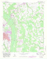
1960 Map of Dillon East
USGS Topo · Published 1961About this map
The Atlantic Coast Line and Seaboard Air Line railroads converge in Dillon, a community shaped by its rail connections and the nearby Little Pee Dee River. This 1960 survey illustrates the town's institutional growth, showing the St Eugene Hospital, the South Dillon School, and Gordon High School. The landscape is defined by the unique elliptical depressions of Carolina bays, such as Lilly Bay, Manning Bay, and Sand Ridge Bay, which create a distinct pattern across the eastern Carolina coastal plain.
Find a feature on this map
87 named features on this map. Tap any name to fly to it.
Don’t see what you’re looking for? This feature index may not catch every label — zoom into the map to look around manually.
Map Details
Editions of this 1960 Dillon East Map
2 editions found
Other maps of this area

1943 · Pages Mill
USGS Topo · 1:62,500

1953 · Florence
USGS Topo · 1:250,000

1954 · Florence
USGS Topo · 1:250,000

1959 · Fork
USGS Topo · 1:24,000

1960 · Latta
USGS Topo · 1:24,000

1960 · Dillon West
USGS Topo · 1:24,000

1962 · Lake View
USGS Topo · 1:24,000

1962 · Gaddysville
USGS Topo · 1:24,000

1962 · Fair Bluff
USGS Topo · 1:62,500

1971 · Minturn
USGS Topo · 1:24,000