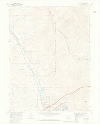
1970 Map of Dillon
USGS Topo · Published 1973About this map
The Blue River valley serves as the central artery for this 1970 landscape, where the growing towns of Silverthorne and Dillon are captured during a period of significant water-management transformation. The southern portion of the map is dominated by the Dillon Reservoir, with its modern Boat Ramp and nearby Ranger Station signaling its role as a regional recreational hub. This survey illustrates the proximity of residential and infrastructure expansion, such as the Trailer Park and Sewage Disposal sites, against the permanent boundary of the Arapaho National Forest.
Find a feature on this map
37 named features on this map. Tap any name to fly to it.
Don’t see what you’re looking for? This feature index may not catch every label — zoom into the map to look around manually.
Map Details
Editions of this 1970 Dillon Map
3 editions found
Other maps of this area

1924 · Montezuma
USGS Topo · 1:62,500

1924 · Fraser
USGS Topo · 1:62,500

1926 · Fraser
USGS Topo · 1:62,500

1926 · Montezuma
USGS Topo · 1:62,500

1929 · Dillon
USGS Topo · 1:62,500

1933 · Montezuma
USGS Topo · 1:62,500

1933 · Ute Peak
USGS Topo · 1:62,500

1934 · Dillon
USGS Topo · 1:62,500

1937 · Ute Peak
USGS Topo · 1:62,500

1953 · Denver
USGS Topo · 1:250,000