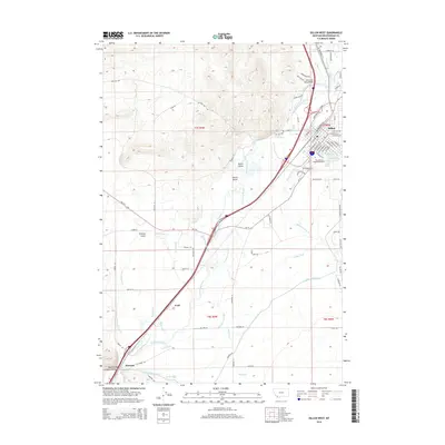
2014 Map of Dillon West
USGS Topo · Published 2014About this map
Dillon serves as the focal point of this southwestern Montana landscape, positioned where the Beaverhead River and Blacktail Deer Cr converge. The settlement pattern reflects the area's academic and agricultural foundations, anchored by The Univ of Montana-Western and a complex network of irrigation infrastructure. This sophisticated water management system is visible through numerous named channels like the East Bench Canal, West Side Canal, and the Owen Ditch, which redirect water across the valley floor to support local ranching.
Find a feature on this map
84 named features on this map. Tap any name to fly to it.
Don’t see what you’re looking for? This feature index may not catch every label — zoom into the map to look around manually.
Map Details
Editions of this 2014 Dillon West Map
This is the sole edition of this map. No revisions or reprints were ever made.
Other maps of this area

1893 · Dillon
USGS Topo · 1:250,000

1952 · Argenta
USGS Topo · 1:24,000

1952 · Burns Mountain
USGS Topo · 1:24,000

1952 · Dalys
USGS Topo · 1:24,000

1952 · Gallagher Mountain
USGS Topo · 1:24,000

1955 · Dillon
USGS Topo · 1:250,000

1957 · Dillon
USGS Topo · 1:250,000

1958 · Dillon
USGS Topo · 1:250,000

1961 · Glen SE
USGS Topo · 1:24,000

1961 · Ashbough Canyon
USGS Topo · 1:24,000