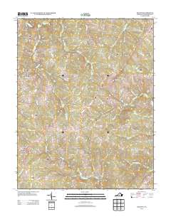
2013 Map of Dillwyn
USGS Topo · Published 2013About this map
Dillwyn serves as a central hub in this Buckingham County landscape, situated where several local routes and landmarks converge. The map documents a rural Virginia economy defined by dispersed settlements such as Alpha, Gravel Hill, and Allenslevel. To the north, Eldridge Mill stands near the headwaters of Joshua Cr, reflecting the region's historic reliance on water-powered milling and local agriculture. The terrain is marked by distinctive elevations like Buffards Mountain and Tower Hill, while water bodies such as Dillwyn Lake and Whispering Cr influence the layout of the road network.
Find a feature on this map
89 named features on this map. Tap any name to fly to it.
Don’t see what you’re looking for? This feature index may not catch every label — zoom into the map to look around manually.
Map Details
Editions of this 2013 Dillwyn Map
This is the sole edition of this map. No revisions or reprints were ever made.
Other maps of this area

1891 · Palmyra
USGS Topo · 1:125,000

1891 · Farmville
USGS Topo · 1:125,000

1892 · Buckingham
USGS Topo · 1:125,000

1892 · Appomattox
USGS Topo · 1:125,000

1893 · Farmville
USGS Topo · 1:125,000

1895 · Palmyra
USGS Topo · 1:125,000

1897 · Palmyra
USGS Topo · 1:125,000

1947 · Roanoke
USGS Topo · 1:250,000

1950 · Dillwyn
USGS Topo · 1:62,500

1958 · Farmville
USGS Topo · 1:62,500