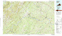
1979 Map of Dillwyn
USGS Topo · Published 1982About this map
The James River carves a winding path through the heart of the Central Piedmont, defining the boundary between numerous counties and serving as a corridor for the Chesapeake and Ohio Railway. This 1970s landscape reveals a rural economy rooted in forestry and agriculture, with large tracts preserved in the Cumberland State Forest and the George Washington National Forest along the Blue Ridge crest. Small crossroads like Buckingham and Dillwyn serve as local hubs, while river towns such as New Canton, Columbia, and Howardsville mark historical points of transit where the rail lines and waterways intersect.
Find a feature on this map
98 named features on this map. Tap any name to fly to it.
Don’t see what you’re looking for? This feature index may not catch every label — zoom into the map to look around manually.
Map Details
Editions of this 1979 Dillwyn Map
This is the sole edition of this map. No revisions or reprints were ever made.
Other maps of this area

1887 · Spottsylvania
USGS Topo · 1:125,000

1890 · Goochland
USGS Topo · 1:125,000

1891 · Palmyra
USGS Topo · 1:125,000

1891 · Farmville
USGS Topo · 1:125,000

1892 · Lynchburg
USGS Topo · 1:125,000

1892 · Buckingham
USGS Topo · 1:125,000

1892 · Appomattox
USGS Topo · 1:125,000

1892 · Spottsylvania
USGS Topo · 1:125,000

1892 · Goochland
USGS Topo · 1:125,000

1892 · Gordonsville
USGS Topo · 1:125,000