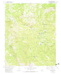
1982 Map of Dinkey Creek
USGS Topo · Published 1983About this map
The Sierra National Forest defines the high-country character of this 1982 survey, centering on the seasonal activity around Dinkey Creek. The area appears as a hub for summer recreation and forestry management, anchored by various organizational retreats including Camp Fresno, Camp Mary-Y-Mae, and Camp El-O-Win. A network of meadows—from Strawberry Meadow to Summit Meadow—suggests the high-altitude grazing and transit patterns of the era, while the Shaver Lookout Tower atop Bald Mountain provided a critical vantage for fire suppression.
Find a feature on this map
61 named features on this map. Tap any name to fly to it.
Don’t see what you’re looking for? This feature index may not catch every label — zoom into the map to look around manually.
Map Details
Editions of this 1982 Dinkey Creek Map
3 editions found
Other maps of this area

1904 · Kaiser
USGS Topo · 1:125,000

1922 · Trimmer
USGS Topo · 1:96,000

1924 · Dinuba
USGS Topo · 1:125,000

1942 · Watts Valley
USGS Topo · 1:62,500

1944 · Watts Valley
USGS Topo · 1:62,500

1947 · Mariposa
USGS Topo · 1:250,000

1948 · Fresno
USGS Topo · 1:250,000

1948 · Mariposa
USGS Topo · 1:250,000

1952 · Patterson Mountain
USGS Topo · 1:62,500

1953 · Huntington Lake
USGS Topo · 1:62,500