1982 Map of Dinkey Creek
USGS Topo · Published 1991About this map
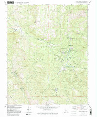
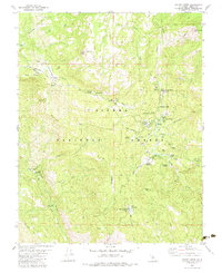
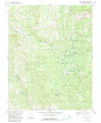
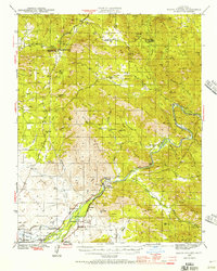
Sierra National Forest surrounds a network of summer camps and specialized work sites in this 1982 map of the Sierra Nevada mountains. The landscape is defined by the winding course of Dinkey Creek and its many tributaries, including Exchequer Creek and Blue Canyon Creek. A cluster of organizational camps like Camp El-O-Win, Camp Fresno, and Camp Mary-Y-Mac suggest the area's established role as a recreational retreat. For those interested in industrial history, the map identifies the Bretz Mill (Site) and a Sawmill Burner, pointing to the logging heritage of the high country. Natural landmarks such as McKinley Grove and Bald Mtn rise above the high-elevation meadows, including Strawberry Meadow and Glen Meadow, which offered respite for both cattlemen and early forest rangers.
Find a feature on this map
56 named features on this map. Tap any name to fly to it.
Don’t see what you’re looking for? This feature index may not catch every label — zoom into the map to look around manually.
Map Details
Editions of this 1982 Dinkey Creek Map
3 editions found
Other maps of this area

1904 · Kaiser
USGS Topo · 1:125,000

1922 · Trimmer
USGS Topo · 1:96,000

1924 · Dinuba
USGS Topo · 1:125,000
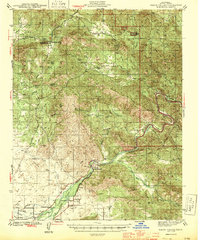
1942 · Watts Valley
USGS Topo · 1:62,500
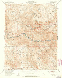
1944 · Watts Valley
USGS Topo · 1:62,500

1947 · Mariposa
USGS Topo · 1:250,000

1948 · Fresno
USGS Topo · 1:250,000

1948 · Mariposa
USGS Topo · 1:250,000
1952 · Patterson Mountain
USGS Topo · 1:62,500
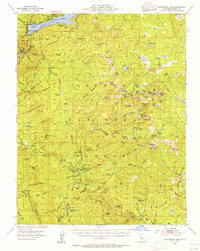
1953 · Huntington Lake
USGS Topo · 1:62,500