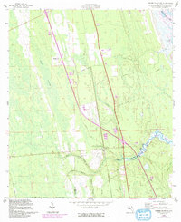
1956 Map of Dinner Island NE
USGS Topo · Published 1992About this map
Fish Swamp dominates the western portion of this 1956 landscape, reflecting the low-lying coastal hydrology typical of the border between St. Johns and Flagler Counties. This mid-century survey, updated with late 20th-century revisions, documents the preservation of natural waterways and timberlands before modern residential development. Along the eastern edge, the Matanzas River and the Intracoastal Waterway define the Atlantic corridor, while Faver-Dykes State Park and an Aquatic Preserve safeguard the brackish ecosystems near Pellicer Creek. Historical transit routes are well-preserved here, including the alignment of Old Kings Road and Old Brick Road. Genealogists and local historians will find value in the location of the Pellicer Creek Cem, situated near the confluence of several drainage branches like Cracker Branch and Pringle Branch.
Find a feature on this map
18 named features on this map. Tap any name to fly to it.
Don’t see what you’re looking for? This feature index may not catch every label — zoom into the map to look around manually.
Map Details
Editions of this 1956 Dinner Island NE Map
4 editions found

Other maps of this area

1927 · Matanzas
USGS Topo · 1:48,000

1937 · Elkton
USGS Topo · 1:24,000

1937 · Crescent Beach
USGS Topo · 1:24,000

1937 · Dinner Island
USGS Topo · 1:48,000

1943 · St. Augustine
USGS Topo · 1:62,500

1943 · Dinner Island
USGS Topo · 1:62,500

1943 · Matanzas
USGS Topo · 1:62,500

1944 · Dinner Island
USGS Topo · 1:62,500

1944 · Matanzas
USGS Topo · 1:62,500

1954 · Daytona Beach
USGS Topo · 1:250,000