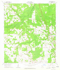
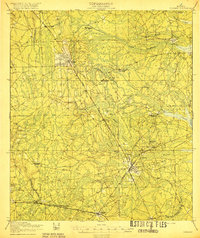
1964 Map of Dinsmore
USGS Topo · Published 1965About this map
Dinsmore and its surrounding wetlands occupy a landscape defined by the branching tributaries of the Trout River and Thomas Creek. In the mid-1960s, this portion of Duval Co and Nassau Co remained a mix of low-lying marshlands and developing rural settlements. The influence of transportation is evident where the Atlantic Coast Line and Southern railroads converge, supporting small communities like Keene and Cary. To the south, the presence of the US Naval Air Station (Whitehouse Field) signals the area's strategic importance during the Cold War era.
Find a feature on this map
32 named features on this map. Tap any name to fly to it.
Don’t see what you’re looking for? This feature index may not catch every label — zoom into the map to look around manually.
Map Details
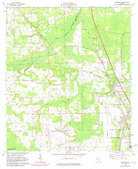
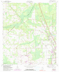
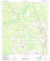
Editions of this 1964 Dinsmore Map
4 editions found
Other maps of this area

1917 · Cambon
USGS Topo · 1:62,500

1917 · Hilliard
USGS Topo · 1:62,500

1918 · St Marys
USGS Topo · 1:62,500

1918 · Cambon
USGS Topo · 1:62,500

1918 · Jacksonville
USGS Topo · 1:62,500

1919 · St Marys
USGS Topo · 1:62,500
1919 · Hilliard
USGS Topo · 1:62,500

1948 · Jacksonville
USGS Topo · 1:250,000

1950 · Trout River
USGS Topo · 1:24,000
1950 · Jacksonville
USGS Topo · 1:24,000