1964 Map of Dinsmore
USGS Topo · Published 1982About this map
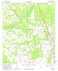
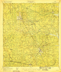
The Trout River and its tributary, the Little Trout River, define the landscape northwest of Jacksonville in this mid-1960s survey with early 1980s updates. The settlement of Dinsmore serves as a local hub, situated where the Seaboard Coast Line railroad and Kings Road converge. The area’s rural roots are evidenced by family-named landmarks like Keen Cem near the small settlement of Keene, and Plummer along Plummer Road.
Find a feature on this map
31 named features on this map. Tap any name to fly to it.
Don’t see what you’re looking for? This feature index may not catch every label — zoom into the map to look around manually.
Map Details
Editions of this 1964 Dinsmore Map
4 editions found
Other maps of this area

1917 · Cambon
USGS Topo · 1:62,500

1917 · Hilliard
USGS Topo · 1:62,500

1918 · St Marys
USGS Topo · 1:62,500

1918 · Cambon
USGS Topo · 1:62,500

1918 · Jacksonville
USGS Topo · 1:62,500

1919 · St Marys
USGS Topo · 1:62,500
1919 · Hilliard
USGS Topo · 1:62,500

1948 · Jacksonville
USGS Topo · 1:250,000

1950 · Trout River
USGS Topo · 1:24,000
1950 · Jacksonville
USGS Topo · 1:24,000