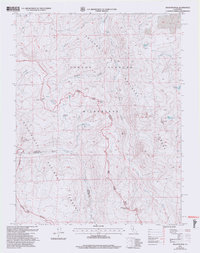
2001 Map of Disaster Peak
USGS Topo · Published 2004About this map
Disaster Peak and the high summits of the Sierra Nevada define this area at the meeting point of the Toiyabe National Forest, Stanislaus National Forest, and the Carson-Iceberg Wilderness. The landscape is dominated by glacial features and alpine basins, where Golden Lake and Poison Lake sit below steep ridgelines. The Pacific Crest National Scenic Trail winds through the central portion of the map, tracing the high country near Whitecliff Peak.
Find a feature on this map
25 named features on this map. Tap any name to fly to it.
Don’t see what you’re looking for? This feature index may not catch every label — zoom into the map to look around manually.
Map Details
Editions of this 2001 Disaster Peak Map
2 editions found
Other maps of this area

1889 · Markleeville
USGS Topo · 1:125,000

1891 · Markleeville
USGS Topo · 1:125,000

1893 · Markleeville
USGS Topo · 1:125,000

1896 · Dardanelles
USGS Topo · 1:125,000

1898 · Dardanelles
USGS Topo · 1:125,000

1948 · Walker Lake
USGS Topo · 1:250,000

1954 · Pickel Meadow
USGS Topo · 1:24,000

1954 · Lost Cannon Peak
USGS Topo · 1:24,000

1956 · Topaz Lake
USGS Topo · 1:62,500

1956 · Markleeville
USGS Topo · 1:62,500