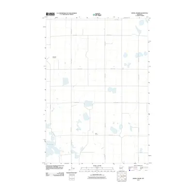
2010 Map of Dismal Swamp
USGS Topo · Published 2010About this map
Maple Cemetery and a network of county roads define this agricultural stretch of Big Stone County during the early 21st century. The landscape is characterized by a high density of wetlands and depressions, notably the Lone Tree Lakebed and established water bodies like Olson Lake and Bentsen Lake. The map reflects a rural environment where land use is dictated by the prairie pothole geography, with section lines strictly followed by the local road system, including County Hwy-21 and County Hwy-8. This survey provides a clear view of the drainage patterns and small-scale landmarks that have anchored this farming community for generations.
Find a feature on this map
15 named features on this map. Tap any name to fly to it.
Don’t see what you’re looking for? This feature index may not catch every label — zoom into the map to look around manually.
Map Details
Editions of this 2010 Dismal Swamp Map
This is the sole edition of this map. No revisions or reprints were ever made.
Other maps of this area

1910 · Chokio
USGS Topo · 1:62,500

1912 · Chokio
USGS Topo · 1:62,500

1950 · Graceville
USGS Topo · 1:62,500

1953 · Ortonville
USGS Topo · 1:62,500

1953 · Milbank
USGS Topo · 1:250,000

1958 · Milbank
USGS Topo · 1:250,000

1968 · Artichoke Lake NW
USGS Topo · 1:24,000

1968 · Artichoke Lake
USGS Topo · 1:24,000

1971 · Dismal Swamp
USGS Topo · 1:24,000

1971 · Odessa
USGS Topo · 1:24,000