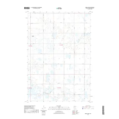
2019 Map of Dismal Swamp
USGS Topo · Published 2019About this map
The low-lying wetlands of Big Stone County dominate this landscape, where the namesake Dismal Swamp and numerous sloughs define the rural character. This interior portion of the county is a complex patchwork of water and prairie, anchored by the Maple Cem near the center of the survey. The mapping reveals a distinct agricultural grid of gravel and section roads, including Co HWY 8 and Co RD 71, which navigate around significant depressions like the Lone Tree Lakebed and Karl Slough. The reliance on local hydrology is evident in the naming of features such as Olson Lake and Bentsen Lake, likely reflecting the legacy of early landholders in the region. Notable is the contrast between established county highways and the smaller routes like the Minimum Maintance Rd, indicating the varying accessibility of this boggy terrain.
Find a feature on this map
32 named features on this map. Tap any name to fly to it.
Don’t see what you’re looking for? This feature index may not catch every label — zoom into the map to look around manually.
Map Details
Editions of this 2019 Dismal Swamp Map
This is the sole edition of this map. No revisions or reprints were ever made.
Other maps of this area

1910 · Chokio
USGS Topo · 1:62,500

1912 · Chokio
USGS Topo · 1:62,500

1950 · Graceville
USGS Topo · 1:62,500

1953 · Ortonville
USGS Topo · 1:62,500

1953 · Milbank
USGS Topo · 1:250,000

1958 · Milbank
USGS Topo · 1:250,000

1968 · Artichoke Lake NW
USGS Topo · 1:24,000

1968 · Artichoke Lake
USGS Topo · 1:24,000

1971 · Dismal Swamp
USGS Topo · 1:24,000

1971 · Odessa
USGS Topo · 1:24,000