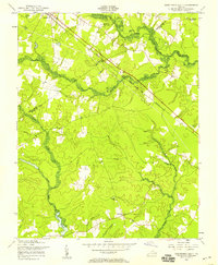
1956 Map of Disputanta South
USGS Topo · Published 1958About this map
Warwick Swamp and the Blackwater River dominate this mid-century landscape where Prince George, Surry, and Sussex counties meet. The area is defined by its low-lying wetlands and the agricultural settlements that avoid them, connected by the diagonal line of the Norfolk and Western railroad. This transportation corridor serves the northern edge of the map, linking the community of Disputanta with the nearby Waverly Airport.
Find a feature on this map
24 named features on this map. Tap any name to fly to it.
Don’t see what you’re looking for? This feature index may not catch every label — zoom into the map to look around manually.
Map Details
Editions of this 1956 Disputanta South Map
This is the sole edition of this map. No revisions or reprints were ever made.
Other maps of this area

1894 · Petersburg
USGS Topo · 1:62,500

1919 · Jarratt
USGS Topo · 1:62,500

1919 · Disputanta
USGS Topo · 1:62,500

1919 · Homeville
USGS Topo · 1:48,000

1920 · Homeville
USGS Topo · 1:62,500

1943 · Manry
USGS Topo · 1:31,680

1943 · Littleton
USGS Topo · 1:31,680

1943 · Savedge
USGS Topo · 1:31,680

1943 · Disputanta
USGS Topo · 1:31,680

1943 · Richmond
USGS Topo · 1:250,000