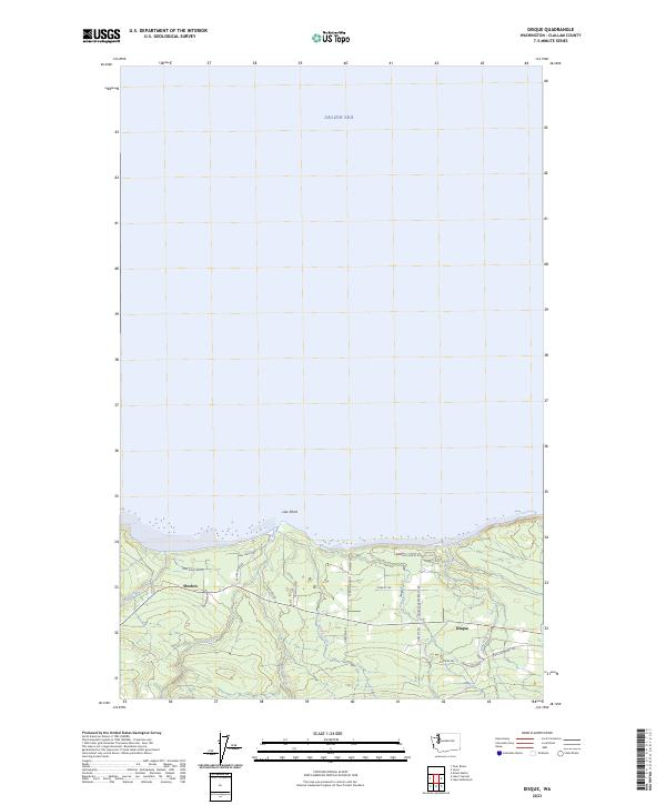
2023 Map of Disque
USGS Topo · Published 2023About this map
The Salish Sea coastline of the Olympic Peninsula defines this coastal study, where the waters meet the rugged shoreline at Low Point. The interior landscape is carved by numerous drainages, most notably the Lyre River, which flows north toward the strait alongside Murdock Creek and Susie Creek. These waterways provide a natural structure to the timbered terrain, influencing the placement of early settlements and rural infrastructure.
Find a feature on this map
30 named features on this map. Tap any name to fly to it.
Don’t see what you’re looking for? This feature index may not catch every label — zoom into the map to look around manually.
Map Details
Editions of this 2023 Disque Map
This is the sole edition of this map. No revisions or reprints were ever made.
Other maps of this area

1918 · Lake Crescent
USGS Topo · 1:62,500

1919 · Port Crescent
USGS Topo · 1:62,500

1922 · Lake Crescent
USGS Topo · 1:62,500

1950 · Mount Muller
USGS Topo · 1:24,000

1950 · Lake Sutherland
USGS Topo · 1:24,000

1950 · Twin Rivers
USGS Topo · 1:24,000
1950 · Joyce
USGS Topo · 1:24,000
1950 · Disque
USGS Topo · 1:24,000

1950 · Lake Crescent
USGS Topo · 1:24,000
1950 · Lake Crescent
USGS Topo · 1:62,500