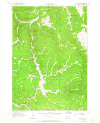
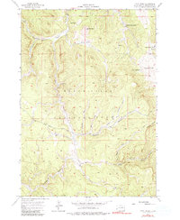
1956 Map of Ditch Creek
USGS Topo · Published 1965About this map
Gillette Prairie and the surrounding high timberland of the Black Hills National Forest define this mid-century topographic study. The landscape is characterized by a network of drainage draws and family-owned ranching operations, including the Hoar Ranch, Sears Ranch, and both the Herman Matt Ranch and Tony Matt Ranch. These named holdings offer a look at the rural land use and genealogy of Pennington County during the 1950s.
Find a feature on this map
31 named features on this map. Tap any name to fly to it.
Don’t see what you’re looking for? This feature index may not catch every label — zoom into the map to look around manually.
Map Details
Editions of this 1956 Ditch Creek Map
5 editions found
Other maps of this area

1894 · Deadwood
USGS Topo · 1:125,000

1896 · Harney Peak
USGS Topo · 1:125,000

1901 · Harney Peak
USGS Topo · 1:125,000

1901 · Deadwood
USGS Topo · 1:125,000

1916 · Deadwood
USGS Topo · 1:125,000

1953 · Rapid City
USGS Topo · 1:250,000

1954 · Berne
USGS Topo · 1:24,000

1955 · Dead Horse Flats
USGS Topo · 1:24,000

1955 · Signal Hill
USGS Topo · 1:24,000

1955 · Hot Springs
USGS Topo · 1:250,000