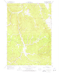
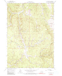
1956 Map of Ditch Creek
USGS Topo · Published 1977About this map
Black Hills National Forest land defines this mid-century landscape, where high-altitude ranching and mining efforts shaped the local economy. The terrain is deeply incised by drainages such as Williams Draw, Sawmill Draw, and Windmill Draw, all contributing to the Sixmile Creek system. This 1956 field-checked survey, produced in cooperation with the United States Atomic Energy Commission, highlights the resource-rich nature of the Pennington back-country during the Cold War era. Cattle ranching on the high meadows is evidenced by several named holdings, including Gillette Prairie and Hoar Ranch. The industrial history of the region is grounded in operations like the Accidental Mine and the Stan-Penn Lode Mine, which sought minerals in the shadow of peaks like Hat Mountain and Odakota Mountain. The network of unimproved roads and the Sixmile Road provide a view of how this rugged interior was accessed before modern development.
Find a feature on this map
27 named features on this map. Tap any name to fly to it.
Don’t see what you’re looking for? This feature index may not catch every label — zoom into the map to look around manually.
Map Details
Editions of this 1956 Ditch Creek Map
5 editions found
Other maps of this area

1894 · Deadwood
USGS Topo · 1:125,000

1896 · Harney Peak
USGS Topo · 1:125,000

1901 · Harney Peak
USGS Topo · 1:125,000

1901 · Deadwood
USGS Topo · 1:125,000

1916 · Deadwood
USGS Topo · 1:125,000

1953 · Rapid City
USGS Topo · 1:250,000

1954 · Berne
USGS Topo · 1:24,000

1955 · Dead Horse Flats
USGS Topo · 1:24,000

1955 · Signal Hill
USGS Topo · 1:24,000

1955 · Hot Springs
USGS Topo · 1:250,000