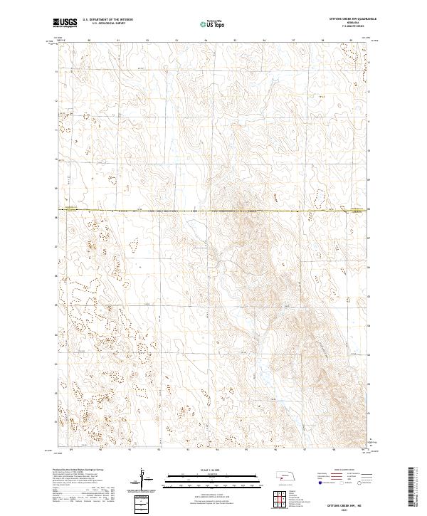
2021 Map of Dittons Creek NW
USGS Topo · Published 2021About this map
Cliff Dwellers Canyon carves through the undulating topography of the Nebraska plains along the border of Perkins and Chase counties. This 2021 survey of the High Plains landscape reveals a strictly ordered grid of section lines and rural thoroughfares such as 750 Rd and 342 Ave, reflecting the enduring Public Land Survey System structure. The terrain is characterized by complex drainage patterns and depressions that contrast with the geometric precision of the county roads. While modern in its data collection, the map provides a clear view of the rural infrastructure and land divisions that have defined this agricultural region for generations, documenting the persistent network of local routes like 747 Rd and 344 Ave that connect isolated properties across the prairie.
Find a feature on this map
23 named features on this map. Tap any name to fly to it.
Don’t see what you’re looking for? This feature index may not catch every label — zoom into the map to look around manually.
Map Details
Editions of this 2021 Dittons Creek NW Map
This is the sole edition of this map. No revisions or reprints were ever made.
Other maps of this area

1954 · McCook
USGS Topo · 1:250,000

1957 · McCook
USGS Topo · 1:250,000

1958 · McCook
USGS Topo · 1:250,000
1973 · Grainton
USGS Topo · 1:24,000

1973 · Imperial NE
USGS Topo · 1:24,000

1973 · Dittons Creek NE
USGS Topo · 1:24,000

1973 · Dittons Creek NW
USGS Topo · 1:24,000
1973 · Elsie
USGS Topo · 1:24,000

1973 · Imperial Municipal Airport
USGS Topo · 1:24,000
1973 · Madrid
USGS Topo · 1:24,000