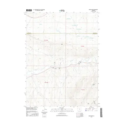
2016 Map of Divide Creek
USGS Topo · Published 2016About this map
Angora sits at the convergence of several drainages in Rio Blanco County, reflecting a landscape defined by water management and high-desert relief. The White River winds through the southern portion of the quadrangle, supported by irrigation infrastructure like the Hammond Ditch. A complex network of reservoirs and creeks dominate the northern half, including Box Elder Reservoir and several segments of the Lower Wolf Cr Reservoir system. The topography is marked by significant erosion patterns, with named features such as School Gulch, Alkali Gulch, and Burnt Gulch carving into the terrain below Coal Ridge. This 2016 survey documents the modern state of these remote water resources and the sparse settlements that have historically relied upon the river valley and its tributary draws for survival in the arid Colorado interior.
Find a feature on this map
35 named features on this map. Tap any name to fly to it.
Don’t see what you’re looking for? This feature index may not catch every label — zoom into the map to look around manually.
Map Details
Editions of this 2016 Divide Creek Map
This is the sole edition of this map. No revisions or reprints were ever made.
Other maps of this area

1907 · Rangely
USGS Topo · 1:125,000

1907 · White River
USGS Topo · 1:125,000

1910 · White River
USGS Topo · 1:125,000

1910 · Rangely
USGS Topo · 1:125,000

1954 · Vernal
USGS Topo · 1:250,000

1958 · Vernal
USGS Topo · 1:250,000

1960 · Vernal
USGS Topo · 1:250,000

1960 · Elk Springs
USGS Topo · 1:62,500

1962 · Cactus Reservoir
USGS Topo · 1:24,000
1962 · Calamity Ridge
USGS Topo · 1:24,000