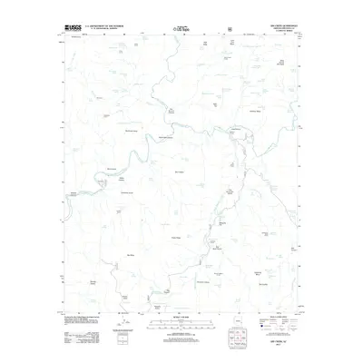
2011 Map of Dix Creek
USGS Topo · Published 2011About this map
The San Francisco River and Blue River converge in this high-desert landscape, creating a network of deep canyons and rugged mesas. This 2011 survey documents a territory defined by ranching and remote water management, evidenced by numerous named corrals and tanks. Martinez Ranch and Ru Ranch appear as the primary human settlements, situated near reliable water sources like Hog Canyon and the San Francisco River. The presence of Dix Creek Corral, Hamilton Mesa Corral, and Sunflower Corral highlights the importance of the livestock industry in this corner of Greenlee County. Topographic features such as Sunflower Mesa, Burro Mesa, and Snake Ridge dominate the terrain, which is carved by drainages like Hackberry Gulch and Hamilton Canyon. This map serves as an essential record of the modern ranching infrastructure and hydrological features that sustain life in this arid region.
Find a feature on this map
124 named features on this map. Tap any name to fly to it.
Don’t see what you’re looking for? This feature index may not catch every label — zoom into the map to look around manually.
Map Details
Editions of this 2011 Dix Creek Map
This is the sole edition of this map. No revisions or reprints were ever made.
Other maps of this area

1902 · Clifton
USGS Topo · 1:62,500

1913 · Morenci
USGS Topo · 1:125,000

1915 · Morenci
USGS Topo · 1:125,000

1954 · Clifton
USGS Topo · 1:250,000

1957 · Clifton
USGS Topo · 1:250,000

1958 · Clifton
USGS Topo · 1:250,000

1962 · Clifton
USGS Topo · 1:250,000

1962 · Clifton
USGS Topo · 1:62,500

1962 · Big Lue Mts
USGS Topo · 1:62,500
1967 · Pipestem Mtn
USGS Topo · 1:24,000