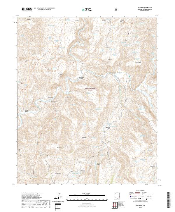
2021 Map of Dix Creek
USGS Topo · Published 2021About this map
Apache National Forest dominates this landscape in Greenlee County, where high plateaus and deep drainages define the canyon country of eastern Arizona. The Blue River carves through the northern half of the quadrangle, flanked by prominent landforms such as Pat Mesa and High Mesa. The network of water sources is extensive for this arid region, featuring numerous cattle tanks and springs such as Yellowjacket Spring, Malpais Spring, and Salt Ground Tank.
Find a feature on this map
123 named features on this map. Tap any name to fly to it.
Don’t see what you’re looking for? This feature index may not catch every label — zoom into the map to look around manually.
Map Details
Editions of this 2021 Dix Creek Map
This is the sole edition of this map. No revisions or reprints were ever made.
Other maps of this area

1902 · Clifton
USGS Topo · 1:62,500

1913 · Morenci
USGS Topo · 1:125,000

1915 · Morenci
USGS Topo · 1:125,000

1954 · Clifton
USGS Topo · 1:250,000

1957 · Clifton
USGS Topo · 1:250,000

1958 · Clifton
USGS Topo · 1:250,000

1962 · Clifton
USGS Topo · 1:250,000

1962 · Clifton
USGS Topo · 1:62,500

1962 · Big Lue Mts
USGS Topo · 1:62,500
1967 · Pipestem Mtn
USGS Topo · 1:24,000