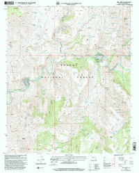
1997 Map of Dix Creek
USGS Topo · Published 2000About this map
Ru Ranch and Martinez Ranch occupy the canyon floors of this remote section of the Apache National Forest in Greenlee County. The landscape is defined by the winding course of the San Francisco River, which cuts deeply through a series of high plateaus including Sunflower Mesa and Lone Tree Mesa. Dozens of springs and tanks, such as Yellow Jacket Spring, Snake Ridge Tank, and Blue Holes Spring, indicate a landscape managed for livestock and water conservation in an arid environment. The presence of numerous named canyons like Bird Canyon and Orejana Canyon suggests a complex drainage system feeding the main river artery. Researchers will find a mix of surveyed topography and Protracted Blocks, marking land of uncertain acreage. Landmarks like Pat Mountain and Seep Spring Mountain provide high-ground survey points overlooking the river's descent through the Frisco Bluff area.
Find a feature on this map
127 named features on this map. Tap any name to fly to it.
Don’t see what you’re looking for? This feature index may not catch every label — zoom into the map to look around manually.
Map Details
Editions of this 1997 Dix Creek Map
This is the sole edition of this map. No revisions or reprints were ever made.
Other maps of this area

1902 · Clifton
USGS Topo · 1:62,500

1913 · Morenci
USGS Topo · 1:125,000

1915 · Morenci
USGS Topo · 1:125,000

1954 · Clifton
USGS Topo · 1:250,000

1957 · Clifton
USGS Topo · 1:250,000

1958 · Clifton
USGS Topo · 1:250,000

1962 · Clifton
USGS Topo · 1:250,000

1962 · Clifton
USGS Topo · 1:62,500

1962 · Big Lue Mts
USGS Topo · 1:62,500
1967 · Pipestem Mtn
USGS Topo · 1:24,000