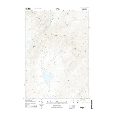
2016 Map of Dix Mountain
USGS Topo · Published 2016About this map
Dix Mountain dominates this high-altitude landscape in the Adirondacks, serving as the center of a complex topography of peaks and deep drainage basins. The area is defined by the sharp verticality of features like Fish Hawk Cliffs and the Colvin Range, which overlook the slender, fjord-like basins of Lower Ausable Lake and Upper Ausable Lake. These water bodies, fed by Cascade Brook and the East Branch Ausable River, represent the headwaters of a major watershed. To the south, the terrain descends toward Elk Lake, where The Narrows and Loon Bay mark a shift in the landscape's character from steep ridges to glacial lakes. Historical landmarks such as Indian Head and Cy Beedes Ledge emphasize the long-standing prominence of these viewpoints, while remote points like Hunters Pass and Elk Pass highlight the naturally defined transit corridors used to navigate this dense mountain cluster.
Find a feature on this map
63 named features on this map. Tap any name to fly to it.
Don’t see what you’re looking for? This feature index may not catch every label — zoom into the map to look around manually.
Map Details
Editions of this 2016 Dix Mountain Map
This is the sole edition of this map. No revisions or reprints were ever made.
Other maps of this area

1894 · Elizabethtown
USGS Topo · 1:62,500

1895 · Elizabethtown
USGS Topo · 1:62,500

1895 · Mt. Marcy
USGS Topo · 1:62,500

1895 · Paradox Lake
USGS Topo · 1:62,500

1897 · Paradox Lake
USGS Topo · 1:62,500

1897 · Schroon Lake
USGS Topo · 1:62,500

1901 · Elizabethtown
USGS Topo · 1:62,500

1902 · Mt. Marcy
USGS Topo · 1:62,500

1950 · Glens Falls
USGS Topo · 1:250,000

1950 · Lake Champlain
USGS Topo · 1:250,000