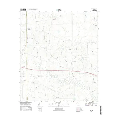
2017 Map of Dixie
USGS Topo · Published 2017About this map
Piscola Creek and its various tributaries, such as Whitlock Br and Allen Br, define the hydrology of this landscape along the Thomas and Brooks county line. The settlement of Dixie serves as a central point, situated along the major corridor of Thomasville Rd and Dixie Hwy. Further east, Emerson appears as a small cluster of activity, while Pidcock and Oaklawn mark established areas to the west and north.
Find a feature on this map
83 named features on this map. Tap any name to fly to it.
Don’t see what you’re looking for? This feature index may not catch every label — zoom into the map to look around manually.
Map Details
Editions of this 2017 Dixie Map
This is the sole edition of this map. No revisions or reprints were ever made.
Other maps of this area

1954 · Valdosta
USGS Topo · 1:250,000

1956 · Grooverville
USGS Topo · 1:24,000

1956 · Monticello NE
USGS Topo · 1:24,000

1956 · Baden
USGS Topo · 1:24,000

1957 · Thomasville
USGS Topo · 1:62,500

1958 · Valdosta
USGS Topo · 1:250,000

1959 · Valdosta
USGS Topo · 1:250,000

1961 · Quitman
USGS Topo · 1:62,500
1974 · Quitman
USGS Topo · 1:24,000
1975 · Pebble Hill
USGS Topo · 1:24,000