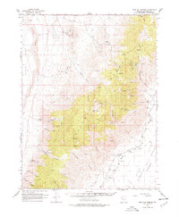
1966 Map of Dixie Hot Springs
USGS Topo · Published 1977About this map
The Stillwater Range dominates this mid-1960s landscape, serving as a high divide between the Carson Sink Alkali Flat to the west and the Dixie Valley Humboldt Salt Marsh to the east. This region is a testament to Nevada's mining and ranching history, where isolated outposts like the Coppereid Ruins and the Dixie (Site) sit at the base of steep canyons. Water is the defining resource here, indicated by the clustered Dixie Hot Springs, Cold Springs, and numerous unnamed springs scattered through Mississippi Canyon and White Rock Canyon.
Find a feature on this map
37 named features on this map. Tap any name to fly to it.
Don’t see what you’re looking for? This feature index may not catch every label — zoom into the map to look around manually.
Map Details
Editions of this 1966 Dixie Hot Springs Map
2 editions found

Other maps of this area

1908 · Carson Sink
USGS Topo · 1:250,000

1910 · Carson Sink
USGS Topo · 1:250,000

1931 · Lovelock
USGS Topo · 1:250,000

1932 · Sonoma Range
USGS Topo · 1:250,000

1935 · Lovelock
USGS Topo · 1:250,000

1939 · Sonoma Range
USGS Topo · 1:250,000

1954 · Buffalo Mtn
USGS Topo · 1:62,500

1955 · Millett
USGS Topo · 1:250,000

1955 · Lovelock
USGS Topo · 1:250,000

1955 · Winnemucca
USGS Topo · 1:250,000