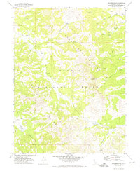
1972 Map of Dixie Mountain
USGS Topo · Published 1974About this map
Dixie Valley serves as the central geological corridor in this pocket of the Plumas National Forest, where the landscape is defined by high-elevation ridges and a network of seasonal springs. Mapping conducted by the U.S. Geological Survey and the U. S. Forest Service in the early 1970s highlights the prominence of Dixie Mountain and its surrounding drainage systems. The map details the remote reaches of the State Game Refuge 1-P, where a complex of drainages including Ramelli Creek, Grigsby Creek, and Frenchman Creek gather from the surrounding peaks.
Find a feature on this map
20 named features on this map. Tap any name to fly to it.
Don’t see what you’re looking for? This feature index may not catch every label — zoom into the map to look around manually.
Map Details
Editions of this 1972 Dixie Mountain Map
2 editions found
Other maps of this area

1886 · Honey Lake
USGS Topo · 1:250,000

1890 · Sierraville
USGS Topo · 1:125,000

1891 · Honey Lake
USGS Topo · 1:250,000

1892 · Sierraville
USGS Topo · 1:125,000

1893 · Honey Lake
USGS Topo · 1:250,000

1894 · Sierraville
USGS Topo · 1:125,000

1950 · Chilcoot
USGS Topo · 1:62,500

1950 · Portola
USGS Topo · 1:62,500

1950 · Milford
USGS Topo · 1:62,500

1954 · Doyle
USGS Topo · 1:62,500