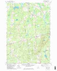
1982 Map of Dixmont
USGS Topo · Published 1982About this map
Mount Harris Lookout Tower stands as the primary topographical landmark in this rural landscape of southern Penobscot and northern Waldo counties. The area is defined by a traditional New England settlement pattern, with small clusters like Dixmont Center, North Dixmont, and East Troy connected by a network of secondary roads such as Garland Road. The terrain is marked by numerous family-named burial sites including Sawyer Cem, Hathaway Cem, and Jewel Cem, which serve as vital markers for local genealogical research. Natural drainage features like Martin Stream and the North Branch Marsh Stream wind through the hills, while Cates Meadows and Skinner Bog suggest the low-lying wetlands that limited development. Numerous gravel pits scattered across the quadrangle point to local extractive industry, while Radio Towers on the heights near Drake Pond indicate the modern infrastructure of the early 1980s.
Find a feature on this map
35 named features on this map. Tap any name to fly to it.
Don’t see what you’re looking for? This feature index may not catch every label — zoom into the map to look around manually.
Map Details
Editions of this 1982 Dixmont Map
2 editions found
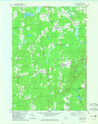
Other maps of this area

1926 · Burnham
USGS Topo · 1:62,500

1930 · Pittsfield
USGS Topo · 1:48,000

1931 · Stetson
USGS Topo · 1:48,000

1932 · Brooks
USGS Topo · 1:62,500

1932 · Pittsfield
USGS Topo · 1:62,500

1933 · Pittsfield
USGS Topo · 1:62,500

1935 · Stetson
USGS Topo · 1:62,500

1948 · Bangor
USGS Topo · 1:250,000

1955 · Pittsfield
USGS Topo · 1:62,500

1955 · Brooks
USGS Topo · 1:62,500