
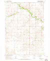
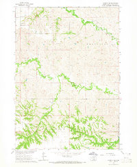
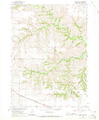
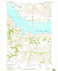
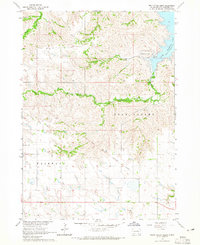
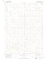
1971 Map of Dixon NE
USGS Topo · Published 1974This historical map portrays the area of Dixon NE in 1971, primarily covering Gregory County as well as portions of Charles Mix County, Brule County, and Lyman County. Featuring a scale of 1:24000, this map provides a highly detailed snapshot of the terrain, roads, buildings, counties, and historical landmarks in the Dixon NE region at the time. Published in 1974, it is the sole known edition of this map.
Find a feature on this map
15 named features on this map. Tap any name to fly to it.
Don’t see what you’re looking for? This feature index may not catch every label — zoom into the map to look around manually.
Map Details
Editions of this 1971 Dixon NE Map
This is the sole edition of this map. No revisions or reprints were ever made.
Historical Maps of Lyman County Through Time
14 maps found

1964 Carlock
Gregory County, SD
1964 Gregory SE
Gregory County, SD
1964 Herrick NE
Gregory County, SD
1964 Herrick NW
Gregory County, SD
1964 Lake Andes SW
Gregory County, SD
1964 South Scalp Creek
Gregory County, SD
1964 Whetstone Bay
Gregory County, SD
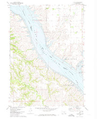
1971 Dixon
Gregory County, SD
1971 Dixon NE
Gregory County, SD
1971 Dixon SE
Gregory County, SD
1971 Dixon SW
Gregory County, SD

1971 Lucas
Gregory County, SD
1971 Lucas SE
Gregory County, SD
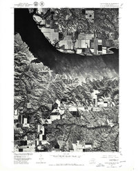
1977 Lake Andes SW
Gregory County, SD
Featured Locations
- Bull Creek Segment, SD
- Charles Mix County, SD
- America Township, SD
- La Roche Township, SD
- Milk's Camp Segment, SD