
1964 Map of Dixon
USGS Topo · Published 1966About this map
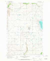
The confluence of the Flathead River and the Jocko River serves as the focal point for this mid-1960s survey of the Flathead Indian Reservation. The settlement of Dixon sits at this strategic junction, where the Northern Pacific railroad tracks follow the river's path through the valley. This landscape is defined by the complex water management systems of the era, including the Lower Revais Jocko Pipeline Canal and the Jocko Canal, which redirect water through the varied terrain of the Moiese Valley.
Find a feature on this map
29 named features on this map. Tap any name to fly to it.
Don’t see what you’re looking for? This feature index may not catch every label — zoom into the map to look around manually.
Map Details
Editions of this 1964 Dixon Map
This is the sole edition of this map. No revisions or reprints were ever made.
Other maps of this area

1956 · Wallace
USGS Topo · 1:250,000

1959 · Alberton
USGS Topo · 1:62,500

1959 · Arlee
USGS Topo · 1:62,500

1960 · Wallace
USGS Topo · 1:250,000

1964 · Mc Donald
USGS Topo · 1:24,000

1964 · Melton Ranch
USGS Topo · 1:24,000

1964 · Ravalli
USGS Topo · 1:24,000

1965 · Sloan
USGS Topo · 1:24,000
1965 · Charlo
USGS Topo · 1:24,000
1984 · Mc Cormick Peak
USGS Topo · 1:24,000