
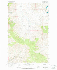
1964 Map of Melton Ranch
USGS Topo · Published 1966About this map
Isolated homesteads and intricate watercourses define this mid-1960s landscape along the Lake Co Sanders Co line. The Little Bitterroot River meanders across the northern plains, while the Flathead River cuts through the northeastern corner, marking the boundary of the region's hydrography. Small-scale ranching operations are the primary sign of human habitation, with established sites such as Melton Ranch, Jennings Ranch, and Anderson Ranch situated near reliable water sources like Whiskey Creek.
Find a feature on this map
17 named features on this map. Tap any name to fly to it.
Don’t see what you’re looking for? This feature index may not catch every label — zoom into the map to look around manually.
Map Details
Editions of this 1964 Melton Ranch Map
2 editions found
Other maps of this area

1920 · Flathead Lake
USGS Topo · 1:125,000

1956 · Wallace
USGS Topo · 1:250,000

1959 · Perma
USGS Topo · 1:62,500

1960 · Wallace
USGS Topo · 1:250,000

1964 · Dixon
USGS Topo · 1:24,000

1964 · Mc Donald
USGS Topo · 1:24,000

1964 · Markle Pass
USGS Topo · 1:24,000

1965 · Sloan
USGS Topo · 1:24,000

1965 · Oliver Point
USGS Topo · 1:24,000
1965 · Round Butte
USGS Topo · 1:24,000